

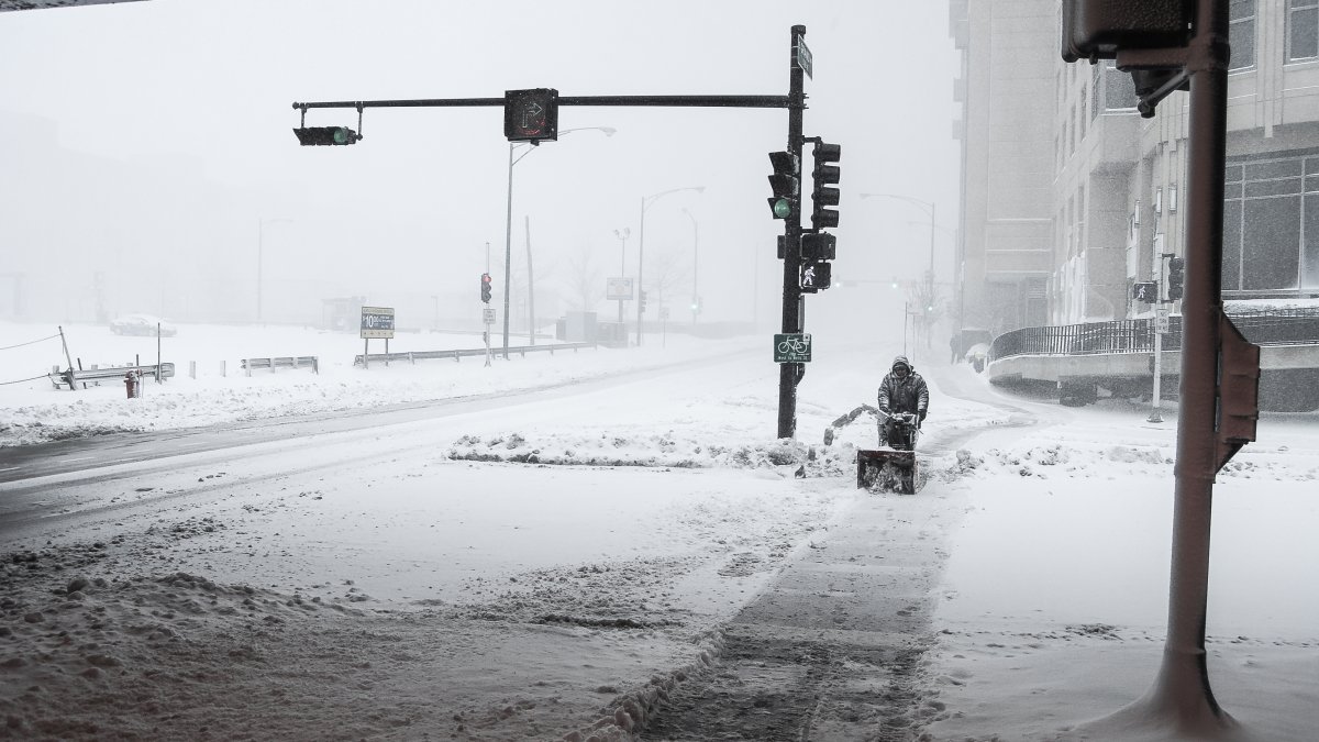
If you’re planning on hitting the road later this week — whether it’s for your usual morning commute, or to head out of town for the holidays — be prepared for delays in the form of frigid temperatures, heavy snow, strong winds and potentially blizzard-like conditions.
While the start to the work week is expected to remain cold, mild and dry, forecast models show the weather will start to turn as early as overnight Monday, when patchy, freezing drizzle is expected to move into the area, mainly northwest of Interstate 55.
But that’s just a taste of what’s in the Chicago forecast for this week.
According to the NBC 5 Storm Team, a winter storm approaching Wednesday and intensifying overnight is predicted to bring heavy snow and windy conditions, beginning around 6 a.m. Thursday and lasting into the evening.
Although the exact storm track hasn’t yet been determined, models predict heavy snow all day Thursday, with decreasing temperatures as the day goes on.
Strong wind gusts over 40 miles-per-hour are also expected to begin Thursday, lasting through Saturday morning, forecast models show.
It’s too early in the week to predict specific snowfall amounts, the NBC 5 Storm Team says. However, heavy flurries mixed with windy, blowing snow and potential lake-effect enhancement could bring possible blizzard conditions Friday.
As for temperatures, forecast models show numbers are expected to be in the low 20s, with frigid wind chills making the air feel much colder.
Travel Impacts
The National Weather Service warns that hazardous travel conditions are expected Thursday through Saturday, with the worst conditions predicted to be Thursday evening through Friday evening. According to models, the greatest threat will be strong, gusty winds and bitter cold temperatures, potentially resulting in power outages and significant lakeshore flooding, mainly for northwest Indiana.
“If possible, those traveling should begin to consider alternate travel plans,” the NWS said in a Tweet.
By the weekend, with temperatures predicted to be below normal, the forecast models show the Chicago area could not only see a White Christmas — which, by definition must include at least one inch of snow on the ground — but a bitterly cold one, too.
According to the NBC 5 Storm Team, Saturday will bring another chance of lake-effect snow to northwest Indiana, with clouds, blowing snow and dangerous wind chills in the city and suburbs.
High temperatures are expected to climb only into the single digits.
And while Christmas Day is expected to be mostly dry with some sunshine, it’ll be an awfully cold holiday, with a high of 12 degrees, NBC 5 Storm Team says.
O’Hare International Airport on Monday was busy but not packed as some travelers got a head start on their Christmas travel this year. And they’re glad to get out early, ahead of a Chicago weather forecast calling for blizzard-like conditions. Kye Martin has more.
What Are Blizzard Conditions?
According to NBC 5 Storm Team, a specific set of conditions must be met in order for a weather pattern to be considered a blizzard. They include snow or blowing snow, wind gusts of at least 35 miles-per-hour, and visibility of a quarter-mile or less.
All three of those conditions must be present for at least three hours for a storm to be labeled a blizzard, NBC 5 meteorologists report.
According to NWS, the snowiest Christmas on record for the Chicago area took place in 1950, when the city say just over five inches of snow.