


CNN
—
A major arctic blast is plunging temperatures to dangerous levels in much of the country and a developing “bomb cyclone” is set to unload heavy snow and blizzard conditions especially in the Midwest on Thursday and Friday – a combination making for a perilous few days leading up to Christmas.
The cold air and storm are affecting nearly every state in some way: More than 110 million people coast-to-coast were under winter-weather alerts for snow or icy conditions Thursday morning, the National Weather Service said.
And more than 90 million people were under wind-chill alerts from the Canadian border to the Mexican border and from Washington state to Florida, with below-zero wind chills recorded as far south as Texas on Thursday morning and expected to reach the Southeast by Friday.
“Life-threatening wind chills over the Great Plains (will) overspread the eastern half of the nation by Friday,” the Weather Prediction Center said – and wind chills below minus 50 degrees already were reported in the past day in parts of Montana, South Dakota and Wyoming.
FOLLOW LIVE UPDATES
Temperatures in some cases plunged with record-breaking speed: Denver saw a 65-degree drop in 16 hours from Wednesday (50 degrees) to Thursday at 5 a.m. (minus 15 degrees). A 37-degree plunge over one hour at Denver International Airport is preliminarily the biggest one-hour drop recorded there, according to the National Weather Service in Boulder.
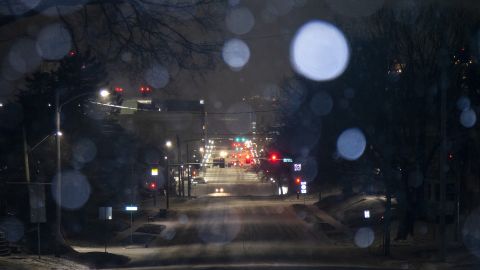
Snow, meanwhile, has been hitting parts of the West and is expected in the next two days across much of the country’s eastern half.
A major snowstorm is shaping up for the Midwest and Great Lakes especially: Widespread light to moderate snowfall, but with powerful winds that may make for impossible travel conditions.
“Heavy snowfall rates of 1-2”/hour, along with wind gusts of over 50 mph will result in near-zero visibility and considerable blowing and drifting of snow,” the prediction center said.
The storm is expected to become a “bomb cyclone” Thursday evening into Friday, reaching the pressure equivalent of a Category 2 hurricane as it moves into the Great Lakes.
More than 1,700 flights have been canceled across the US on Thursday, according to the flight tracking site FlightAware, snarling air travel amid the busy holiday season.
Nearly zero visibility on the roads led to many highway closures between Colorado and Wyoming on Wednesday. The Wyoming Highway Patrol said it responded to nearly 800 calls for service in a 12-hour period Wednesday, telling motorists to stay off the roads.
In South Dakota, more than 100 vehicles were stranded on snow-covered roadways under low visibility conditions Wednesday night, the Pennington County Sheriff’s Office said.
Even Florida won’t be spared, with residents of the Sunshine State expected to see sudden temperature drops Friday. Some cities in the South – including Nashville and Memphis – are expected to see snow Thursday.
Flooding, meanwhile, is possible in parts of the Northeast, including Washington and Philadelphia, as rain hits the area Thursday before temperatures plummet overnight and bring a “flash freeze.”
President Joe Biden received a briefing on the weather Thursday morning at the White House, from the National Weather Service and Federal Emergency Management Agency. He encouraged Americans to heed the warnings of local officials and to stay safe in the face of the extreme cold.
“This is really a very serious weather alert here,” Biden said, adding that the White House has reached out to 26 governors in the affected regions.
• Snow already was falling Thursday morning from Colorado to Michigan
• Snow and high winds are expected to make for terrible travel conditions from eastern Montana and the northern Plains into the Midwest and upstate New York.
• Blizzard warnings – meaning snow and wind of 35 mph will frequently reduce visibility to less than a quarter of a mile for at least three hours – were in effect Thursday morning in some of those areas, including just southwest of Minneapolis; just south and east of Chicago, and western and northern Michigan.
• Snow is expected to hit Chicago around noon.
• Major cities including Minneapolis, Chicago, Kansas City, St. Louis, Indianapolis, Cleveland and Detroit are under winter storm warnings.
• Wind chill warnings, watches and advisories were in effect for more than 30 states from Washington to Florida on Thursday.
• The arctic front will push south into the Gulf of Mexico and sweep off the Eastern Seaboard by late Friday, bringing cold into the Deep South.
• Thursday’s daytime temperatures may stay below zero in the northern Plains and get barely above that in the central Plains.
• Areas further south – Texas and the Gulf Coast – will see temperatures in the single digits and teens Thursday evening, the Storm Prediction Center said.
• Officials in several southern states are warning residents to take precautions. Alabama warned Thursday and Friday would likely feature “the coldest December airmass to hit the state since 1989,” the state’s emergency management agency said. Friday’s lows in that state were expected to range from the single digits in the north to the low 20s by the Gulf of Mexico.
• Louisiana Gov. John Bel Edwards asked residents Thursday to check on friends and family members that might have a hard time with the frigid temperatures. Lows Friday and Saturday were expected to be in the teens and 20s there.