

National Weather Service graphic.
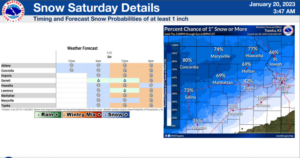
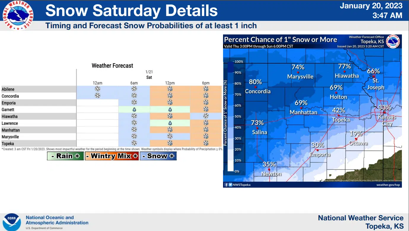
Isolated travel issues are possible with a round of light snowfall Saturday morning. More widespread travel issues could develop after sunset.
The National Weather Service now expects less than an inch of snowfall for Lyon and surrounding counties, and places east of a Council Grove to Strong City line may get no more than a dusting. Rainfall becomes likely for the afternoon, possibly melting the snowfall in the process, before a rain-snow mix could develop between sunset and midnight — which could well lead to more widespread travel concerns than the morning snow. Temperatures will start in the mid-20s Saturday and climb to near 40 degrees before falling back into the mid- and upper 20s for early Sunday.
Around 0.20 inches of total precipitation could come with this winter storm.
Another wintry mix of rain, snow and freezing rain is possible Monday night into Tuesday. Travel issues could also come with that winter storm.
Stay with KVOE, KVOE.com and KVOE social media for updates.