

BOSTON – Another round of snow and rain is on the way for Sunday night through Monday as a strong coastal storm moves up the coast just in time for the start of the work and school week.
Most of the day Sunday will be dry, however the clouds stick around. It’s not until after sunset rain and snow moves in.

CBS Boston Graphic
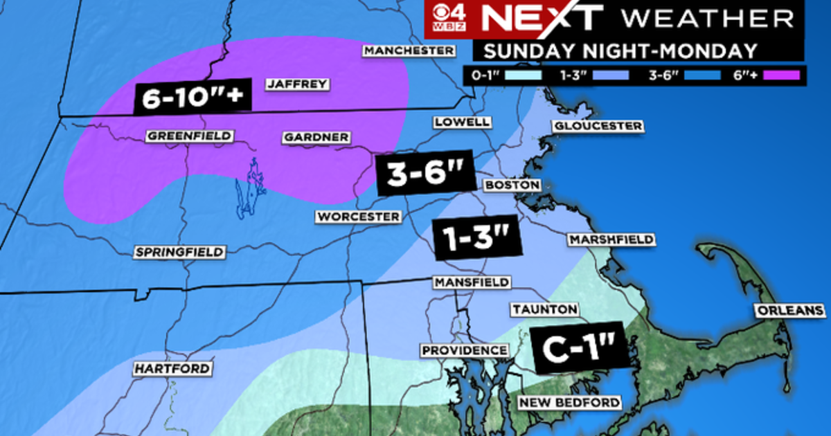
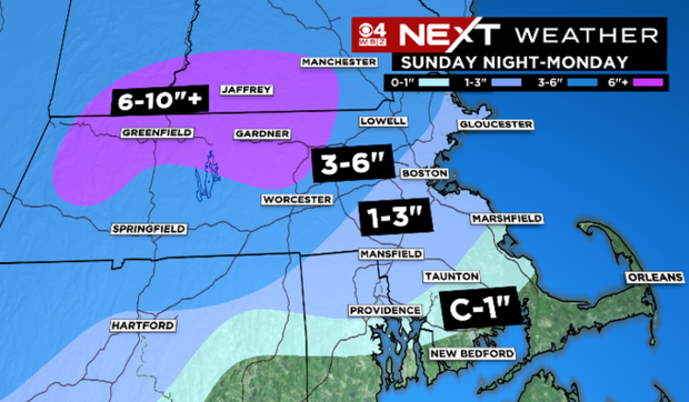
Eastern portions of the state will see mainly rain tonight with snow farther north and west, however the storm is trending colder with a changeover to snow even down to the coast Monday. Significant snow accumulation is expected for northern and western parts of the state, especially in the higher elevations.
CBS Boston Graphic
Some periods of heavy rain are possible Sunday night into early Monday with then colder air changing over rain to snow mid-day Monday through the afternoon and continuing through the evening.
A wet, pasty consistency of snow is expected which may lead to slick travel especially for the Monday afternoon and evening. Some power outages are also possible with the heavy snow weighing down branches, especially in northwestern Massachusetts and southern New Hampshire.

CBS Boston Graphic

CBS Boston Graphic
Winter Storm Warnings and Advisories have been issued for most of the state from 7 p.m. Sunday until 1 a.m. Tuesday. Winds will be gusty.
While we are not expecting damaging winds, gusts over 30 MPH are still possible though at the coast.

CBS Boston Graphic
Some minor coastal flooding is possible, especially mid-day and early afternoon with tides still running astronomically high. A Coastal Flood Advisory is in effect for some coastal communities from 10 a.m.-2 p.m. on Monday.

CBS Boston Graphic
We get a little break in the action Tuesday with breezy but mostly sunny conditions before our next storm on tap for late Wednesday into Thursday. This one looks to start as more snow with colder air in place and then change to rain Thursday morning before moving out.
Thanks for reading CBS NEWS.
Create your free account or log in
for more features.