
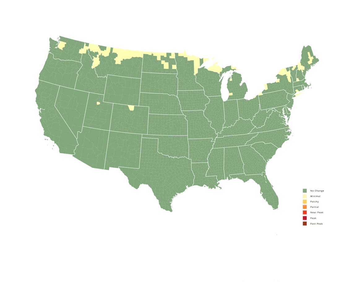
2022 Fall Foliage Prediction Map
If you’re yearning for the beauty of fall, this Fall Foliage Prediction Map might be the perfect tool to help you work out when the leaves will turn—just perfect for planning a picnic, a walk or a weekend away across the U.S., with stunning photo opportunities to match.
The tool is designed by SmokyMountains.com, a travel company that promotes the region. After several years of answering questions from tourists about the best time to visit to see the leaves and colours of fall in their prime, it designed a fall leaf map. SmokyMountans.com says that people use it to plan weddings, vacations and photography trips—many though, just use it to see when the leaves will peak in their neighborhoods.
The tool is programmed to show the foliage for each week over fall. The map is self-explanatory: the green indicates the trees in that area of the U.S. have not begun to change colors, whilst once the colors turn brown, the leaves are past their peak.
The map is designed by David Angotti, the founder of SmokyMountains.com, who has a statistical background—as a former Airline Transport pilot, Angotti is trained in meteorological tools and understands weather patterns.
Angotti explains that “the backbone of the map is meteorology—temperature, moisture, sunlight and precipitation. While meteorology is most accurate immediately before an event, a forecast is more useful to travelers and end users when made in advance.”
By using a blend of historical and forecast data, the company believes it is able to make a highly accurate prediction by the end of August each year.
For the first time, users of the map can also report on the fall foliage in their areas, which will help to refine the tool for its update at the end of September and also in the coming years.